
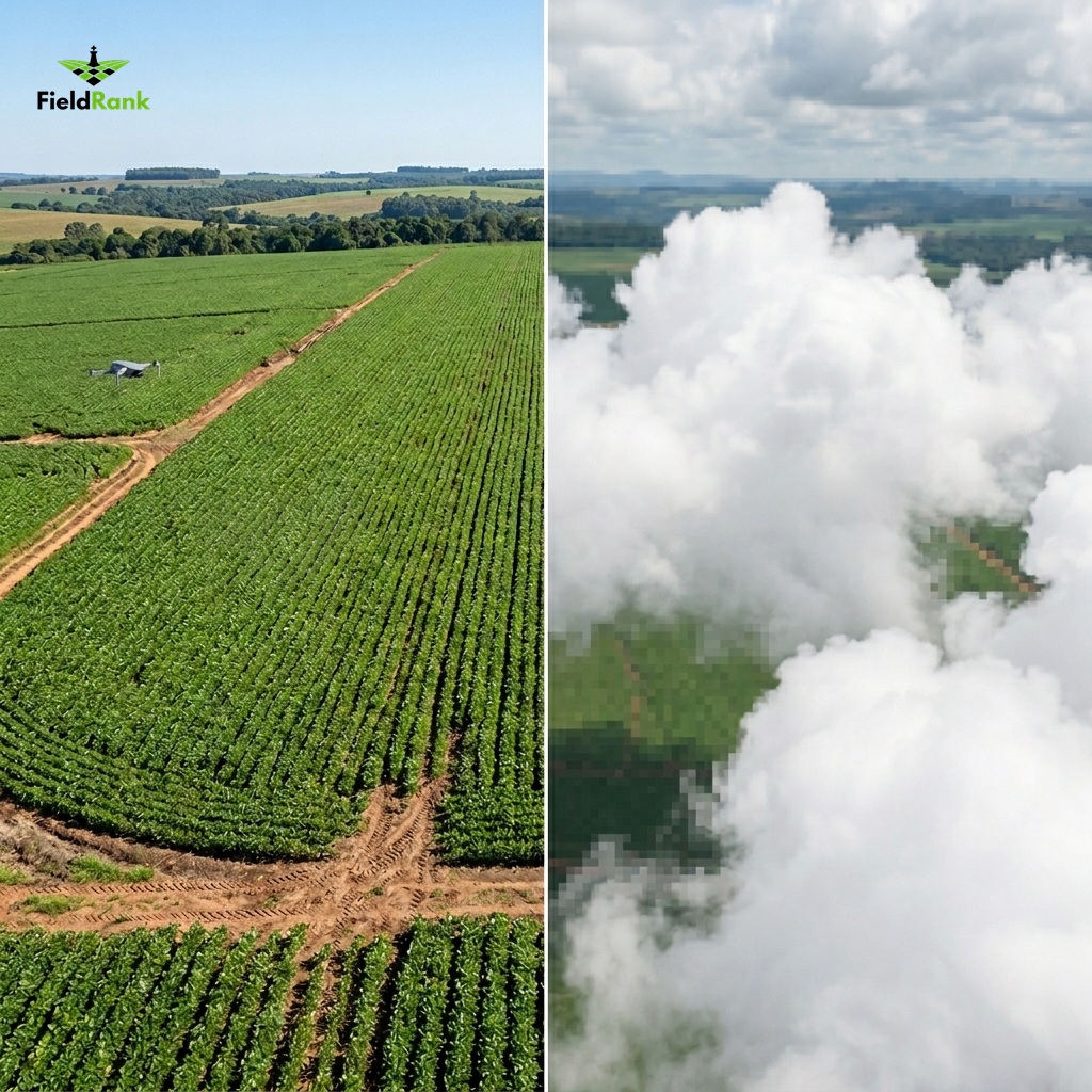
Satellite vs. Drone in Agriculture: Why Your Crop's Window of Opportunity Won't Wait for the Sky to Clear
Discover why relying solely on satellite imagery can cost your harvest dearly. Understand the technical superiority of drones in capturing precise, on-demand data.
The dilemma of the modern agricultural manager is often a race against time. In a scenario where profit margins are defined by decisions made in crucial days—or even hours—outdated information is not just a delay; it is a silent loss. Many producers still ask themselves: "Why invest in a drone operation if I have access to free satellite imagery?". The short answer is that in agriculture, precision and opportunity are non-negotiable. While satellites offer a macro and generic view, drones deliver the intelligence needed for execution.
The Cloud Cover Problem: The Satellite's "Blind Spot"
Atmospheric physics is relentless. Most short-cycle crops, such as soybeans and corn, develop precisely during the rainy season. It is at this time that cloudiness reaches its peak, creating a "blind spot" for satellite optical sensors. As pointed out by technical studies, cloud cover is the main factor that makes satellite imagery unusable at critical moments, such as pre-canopy closure or fungicide application (EOS, 2022).
Unlike satellites, which depend on a fixed orbit and ideal atmospheric conditions, drones operate below the cloud layer. This ability to "fly under" ensures that data is collected exactly when the crop needs monitoring the most, eliminating dependence on clear-sky windows that often do not coincide with agronomic needs.
Spatial Resolution: What You Don't See from 10 Meters Up
Spatial resolution, measured by GSD (Ground Sampling Distance), is the watershed between "seeing" and "perceiving." Conventional satellite imagery operates at resolutions around 10 meters per pixel. This means each pixel is an average of a vast area where soil, plants, and shadows mix—the so-called "mixed pixel."
In contrast, drones operating at low altitudes deliver resolutions of 4 to 8 centimeters per pixel. This difference in scale is brutal. While a satellite only indicates a "patch" of reduced vigor, a drone allows for the individual identification of planting gaps, early pest outbreaks, or specific nutritional deficiencies (Geosense, 2023). As highlighted in research by Embrapa, high resolution is fundamental for production planning and for identifying anomalies that, if detected early, can be corrected with surgical interventions (Embrapa, 2025).
The Acquisition Interval Trap
The revisit time of a satellite—the interval between one pass and another over the same point—generally varies between 5 to 15 days. For a manager who needs to decide on nitrogen application or pest control, 15 days is an eternity. In that interval, a pest can decimate an area or a nutritional deficiency can become irreversible.
The drone's flexibility is its greatest strategic advantage. Image acquisition can be done on-demand, on the desired day and time. This ability to ensure that the set of images is obtained in a specific phenological phase is what differentiates the farmer who "reacts" to the problem from the farmer who "anticipates" the solution.
The Real Cost of Information: Free vs. Expensive
There is a myth that satellite imagery is "free." In reality, the opportunity cost of a wrong decision—based on outdated or cloud-masked data—is immensely higher than the cost of a drone operation. High-resolution satellite imagery, which attempts to compete with drone quality, has prohibitive costs and still suffers from the same atmospheric limitations.
FieldRank has democratized this access by transforming heavy processing into the cloud. It is no longer necessary to invest in computers with powerful GPUs or complex geoprocessing software. The producer focuses on the operation, while our platform converts rapid capture into agronomic intelligence.
Conclusion: The Transition from "Observation" to "Execution"
Agricultural monitoring should not be an exercise in contemplation, but an execution tool. While satellites serve for historical and macro analysis, drones are the precision instrument that allows for variable rate application and localized management.
FieldRank understands that your time is the scarcest resource on the farm. That is why our technology was designed so that you not only see what is happening but know exactly where to act. By integrating high-resolution data with the agility of a simple operation, you stop managing by the average and start protecting the potential of every cell in your crop.